This is a wonderful free exhibition at the Bodleian Library, Oxford which highlights some of their collection of 1.5 million maps. They range from wartime maps to help conceal vital sites from the Germans, to the earliest local maps based on parishes, with the small plots, to maps from other parts of the world which will challenge how we see our own world. This is a wonderful silk wool tapestry showing Gloucestershire and the Forest of Dean.


Local parish map showing details of land and its use

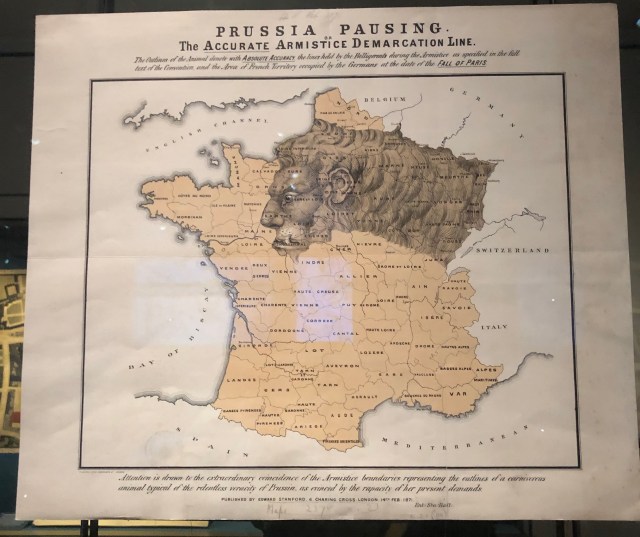
A map of Prussia as a lion planning to devour Europe.
This shows landmarks round coast which were protected by law to provide navigation points for sailors.


A wonderful leather embossed bag to protect a mariner’s maps

Some maps in Arabic, so different to western forms


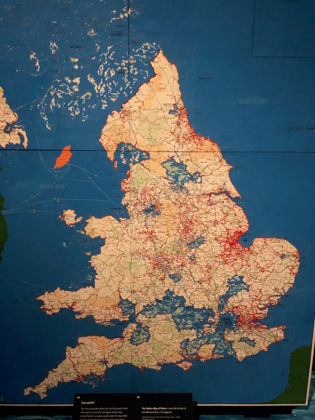
And thoroughly up to date, a Brexit map: Leaver areas are in blue suggesting they sank beneath the waters.
And my favourite, a Polynesian map which is utterly bewildering, and unusual in being made from bamboo.

